
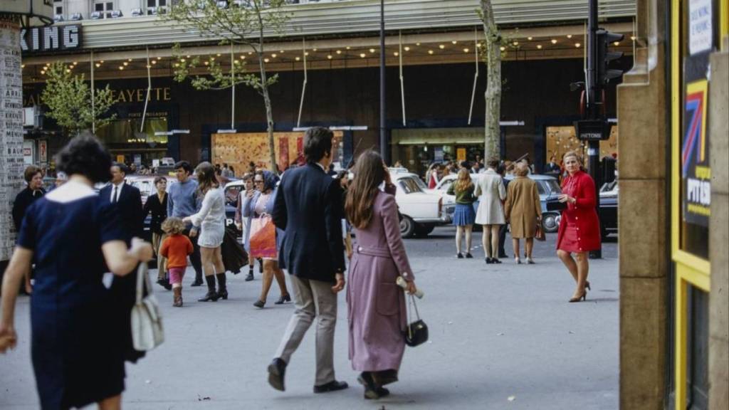

A street filled with cars, a storefront that no longer exists, a construction site at the base of a building, or simply Parisians pausing in front of a café. The Paris 1970 website offers a fascinating glimpse into the capital as it was more than half a century ago, featuring tens of thousands of photographs taken throughout the city.
These images come from a massive photography contest organized in the spring of 1970 by Fnac and the City of Paris. The concept was ambitious: to ask amateur photographers to document as much of Paris as possible. In total, some 2,800 participants produced more than 90,000 photographs. This exceptional collection offers a unique perspective on Paris at a time when the city was changing at breakneck speed.
A map to rediscover 1970s Paris, neighborhood by neighborhood
Rather than simply scrolling through a gallery of old photos, Paris 1970 lets you explore the capital geographically. The digitized photos are linked to small areas measuring approximately 250 meters by 250 meters. So all you have to do is search for a familiar neighborhood to discover the surrounding streets as they were more than 50 years ago.
Sometimes you can immediately recognize an intersection, a metro station, or a building. Elsewhere, everything has changed. At Les Halles, the old market was in its final years before the major demolitions. In other neighborhoods, local shops still played a significant role, storefronts were covered with advertisements, and cars were parked almost everywhere.
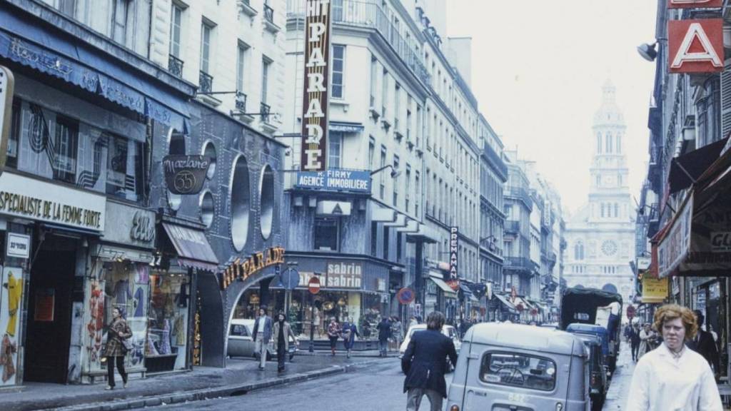
Moreover, 1970 is a particularly interesting year to examine. The Montparnasse Tower was beginning to rise from the ground, construction of the périphérique was underway, Les Halles was about to disappear, and many neighborhoods were undergoing profound transformations.
If you know your neighborhood well, the experience quickly turns into a game of comparing present-day Paris with that of 1970. Some streets look almost identical. Others have become unrecognizable. Check it out!
Website: Paris 1970 – paris1970.jeantho.eu